How hard could it be
After enjoying the last trip to The Blue Mountains, we decided to define our own track around some of the plateau areas of the mountains around Kanangra Walls. Most of the trip was defined around some old tracks marked on the Blue Mountains Sketch map. Although things didn’t go completely to plan, the walk was still a success and a lot of fun.
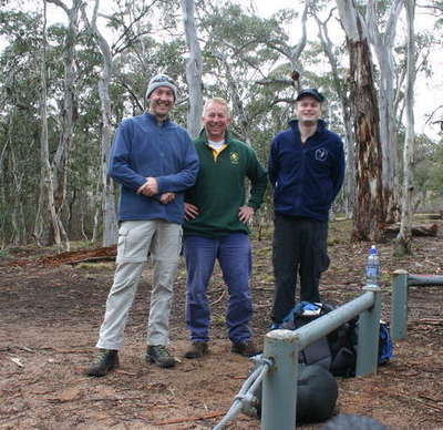
Arriving at the Boyd River camp site at around 7:15pm, the rain had already started. The weather looked like it might change, so Richard and I continued to set up camp and start up the fire. The rain soon stopped and our tents were up, food on the fire and well and truly heated up when Doug arrived. We ate and drunk a few drinks before hitting the sack well after midnight. Hopefully the next day the weather will be perfect for walking!
Day 1 – Saturday
We were up early and the weather was looking much better for walking. The sun was out, and the air was crisp. We set off to locate the starting point of this trip a little after 9:00am. The track started on the corner of the Kanangra Walls road on Kanangra Pass. It was an unusual place to start, but we just stepped off the road and into the bush!

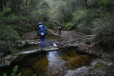
Most of the trail here was pretty easy, open wooded area, so we had no trouble finding our way down the hill towards the creek crossing. The creek was much larger than expected, with lovely waterfalls and cascades cutting through the rocks. After we crossed the creek, we headed off to Sunshine hill for our morning tea.
We had a little trouble moving through some thick scrub at one stage. It made us think a little more about what the rest of the trip might hold, but we chose to push on. After our break at Sunshine hill, we moved on towards Barrallier Plateau. Most of the trail was easy enough to traverse, but once we hit the bottom of the plateau, we were completely blocked from getting any further by the thick bush!! We debated for a while on what to do, and the only thing that we could, was turn around and head back the way we came.
We made it back to Sunshine hill again for lunch at 1:30pm before turning to the East and heading towards Wallarra Heights. That was going to be the point were we would head towards the camp site.
Once again there was more thick scrub to contend with!! There were some spectacular views as we moved across some of the ridge, but we soon realized that the thick scrub was going to make moving to camp very difficult. We planned on simply heading straight down the valley and into the river bed at the bottom and walking towards camp from there.

It took us some time to get to the bottom of the valley, and some blood, sweat and tears shed in bucket loads! Ok, the sweat was but perhaps not the tears, we are blokes after all!!
Walking along the river bed was amazing as there was plenty of water in there and some beautiful waterfalls and cascades to be seen. Two members of the party had trouble with footing at this stage. Yes, Doug and Richard both took a spill!!
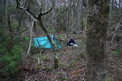
It took a while to find some level ground, and by now it was getting on to 4:00pm which was later than we were hoping to find camp. The site we found was not ideal, but it was going to be good enough and was located next to an amazing waterfall. We set up camp quickly, and then went on the hunt for some firewood to take off the nightly chill.
Once everything was in order, we sat back along side the river, fire blazing, fun and frivolity flowing in abundance! Before the night came to an end, the rain had started. Only a few drops at this stage, but it was not looking promising for tomorrow’s activity!
Day 2 – Sunday
Nobody felt like getting out of the tents in the morning as the sound of rain was still falling outside. I finally rose at around 7:30am. And yes it was wet and miserable outside, but it was not looking like breaking so we had may as well get up. The other guys were up soon enough too, and we found out Doug had already had his breakfast before even leaving the safety of his tent!
By the time we had sorted the morning out and packed our bags, it was after 9:30am and still raining! So our packs were a little heavy from the waterlogged gear, but we pushed on. We had decided to abandon the original plan we had, and just head straight back out of the valley and to the dry, warmth of the cars.

We started heading East along the creek, before crossing at a suitably narrow and shallow section. Richard was doing a great job managing the map as we located the appropriate ridge line to head up and out of the main valley along Dione creek. Once again there was plenty of wonderful water features along the way, perfect for photography if the rain was not so heavy!
There was a couple of thick scrub sections that we had to traverse, but nothing as bad as Saturday. It took us some time before we got up the majority of the steep valley. We got to the final ridge after about two hours, and then it was not long before we hit the road, and only about 50m from the car!
We moved on from there to Kanangra Walls tourist area to find shelter and some other brave adventurers drying out and warming up.
Overall, the trip was definitely a difficult one. It was a true test of human survivability and a confirmation of navigational skills! Not a trip that hikers should attempt without a someone with plenty of off-track experience.
Final word: What doesn’t kill us, makes us stronger.
Google Maps
- all
- day-01
- day-02
- waypoints
![Wallarra Heights Wallarra Heights - Difficult weekend in the mountains<div style='float: right;'>[2007:08:18 07:28:07] [WALLARRA-20070818-01.jpg]</div>](../CACHE/THUMB/Thumb-20070818WallarraWALLARRA-20070818-01.jpg.jpg)
![Wallarra Heights Wallarra Heights - Difficult weekend in the mountains<div style='float: right;'>[2007:08:18 08:31:19] [WALLARRA-20070818-02.jpg]</div>](../CACHE/THUMB/Thumb-20070818WallarraWALLARRA-20070818-02.jpg.jpg)
![Wallarra Heights Wallarra Heights - Difficult weekend in the mountains<div style='float: right;'>[2007:08:18 09:10:44] [WALLARRA-20070818-03.jpg]</div>](../CACHE/THUMB/Thumb-20070818WallarraWALLARRA-20070818-03.jpg.jpg)
![Wallarra Heights Wallarra Heights - Difficult weekend in the mountains<div style='float: right;'>[2007:08:18 10:22:08] [WALLARRA-20070818-04.jpg]</div>](../CACHE/THUMB/Thumb-20070818WallarraWALLARRA-20070818-04.jpg.jpg)
![Wallarra Heights Wallarra Heights - Difficult weekend in the mountains<div style='float: right;'>[2007:08:18 10:35:20] [WALLARRA-20070818-05.jpg]</div>](../CACHE/THUMB/Thumb-20070818WallarraWALLARRA-20070818-05.jpg.jpg)
![Wallarra Heights Wallarra Heights - Difficult weekend in the mountains<div style='float: right;'>[2007:08:18 11:18:34] [WALLARRA-20070818-06.jpg]</div>](../CACHE/THUMB/Thumb-20070818WallarraWALLARRA-20070818-06.jpg.jpg)
![Wallarra Heights Wallarra Heights - Difficult weekend in the mountains<div style='float: right;'>[2007:08:18 13:56:43] [WALLARRA-20070818-07.jpg]</div>](../CACHE/THUMB/Thumb-20070818WallarraWALLARRA-20070818-07.jpg.jpg)
![Wallarra Heights Wallarra Heights - Difficult weekend in the mountains<div style='float: right;'>[2007:08:18 14:49:49] [WALLARRA-20070818-08.jpg]</div>](../CACHE/THUMB/Thumb-20070818WallarraWALLARRA-20070818-08.jpg.jpg)
![Wallarra Heights Wallarra Heights - Difficult weekend in the mountains<div style='float: right;'>[2007:08:18 14:52:30] [WALLARRA-20070818-09.jpg]</div>](../CACHE/THUMB/Thumb-20070818WallarraWALLARRA-20070818-09.jpg.jpg)
![Wallarra Heights Wallarra Heights - Difficult weekend in the mountains<div style='float: right;'>[2007:08:18 14:53:03] [WALLARRA-20070818-10.jpg]</div>](../CACHE/THUMB/Thumb-20070818WallarraWALLARRA-20070818-10.jpg.jpg)
![Wallarra Heights Wallarra Heights - Difficult weekend in the mountains<div style='float: right;'>[2007:08:18 16:22:54] [WALLARRA-20070818-11.jpg]</div>](../CACHE/THUMB/Thumb-20070818WallarraWALLARRA-20070818-11.jpg.jpg)
![Wallarra Heights Wallarra Heights - Difficult weekend in the mountains<div style='float: right;'>[2007:08:18 16:26:06] [WALLARRA-20070818-12.jpg]</div>](../CACHE/THUMB/Thumb-20070818WallarraWALLARRA-20070818-12.jpg.jpg)
![Wallarra Heights Wallarra Heights - Difficult weekend in the mountains<div style='float: right;'>[2007:08:18 16:29:24] [WALLARRA-20070818-13.jpg]</div>](../CACHE/THUMB/Thumb-20070818WallarraWALLARRA-20070818-13.jpg.jpg)
![Wallarra Heights Wallarra Heights - Difficult weekend in the mountains<div style='float: right;'>[2007:08:18 16:29:46] [WALLARRA-20070818-14.jpg]</div>](../CACHE/THUMB/Thumb-20070818WallarraWALLARRA-20070818-14.jpg.jpg)
![Wallarra Heights Wallarra Heights - Difficult weekend in the mountains<div style='float: right;'>[2007:08:19 09:02:39] [WALLARRA-20070819-15.jpg]</div>](../CACHE/THUMB/Thumb-20070818WallarraWALLARRA-20070819-15.jpg.jpg)
![<div style='float: right;'>[a map.jpg]</div>](../CACHE/THUMB/Thumb-20070818Wallarraamap.jpg.jpg)
