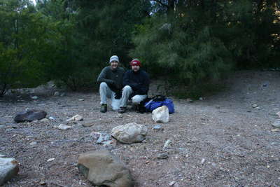
Our travel time from Wollongong was four hours, and we started the weekend with Friday night at Boyd's River Crossing camp site. Of course when we arrived (7:00pm) the camp was empty, but people started rolling up a little later until there was at least another six campsites occupied. The night was pretty cold, and we actually heard some dingoes howling during the night!
Day 1 - Saturday
The morning was clear, and a little frosty. The temperature was around -1 degree and it took a little encouraging for Eddy to get up out of his tent! With that done, breakfast was taken and camp site was packed up. We were having a little trouble getting the GPS to work, but eventually (latter into the walk) we realized that the GPS was lost! So we had to do a location reset, and within 30 seconds everything was good again.

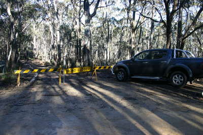
We managed to leave the camp site at 9:20am. About 2km down the road, we found the rest of the fire trail we were supposed to be driving along, was closed!! We had suspected this might be the case, but were still disappointed that we were adding 2.5km to our weekend walking!
We made good time though, and the track for the first few km's was easy to follow. It was essentially an old fire trail, so this part of the trip was no problem. There was some nice wooded areas, and a small creek crossing, before arriving at Lost Rock at 10:30am. From here there were some amazing views out to the East.
Leaving Lost Rock at 11:00am, there was a nice camp area and creek access just to the South, something useful for future. The track was more difficult to find at this stage, so we just stuck to the ridge line and carried on. Of course when the track does disappear, remember that it is not going to be too far away.
There was a lot of hard walking from this point on. And after a couple of false peaks, we arrived at Mount Savage around 1:30pm for a quick lunch. At this stage we had realized that the 18km to The Kowmung was going to be a lot of work! In preparation for our return journey, Eddy set aside a bottle of water to lighten his load.
From here we continued on a steady pace down hill mostly. There were some amazing stands of Native Grass on the ridge tops, more than I had ever seen before. It was easy to get lost though, we made a couple of wrong turns, or in fact failure to turn. It is very easy to continue along a ridge line a little too far. However, we did know what direction we needed to be heading, so we were confident that we would still find The Kowmung at the bottom of the hill.

We found an amazing lookout at the top of Lannigans spur. A view looking out towards the South West. It also gave us a view of the next 600m of elevation that we needed to lose! Heading down Lannigans Spur was very hard work. It is very steep and hard to follow the track. But after an hour, we managed to find the bottom and the amazing Kowmung River!! It was just before 5:00pm now, and we only had about 5 minutes of daylight left!!
We quickly put up the tents on a small sandy section, and then I headed off to collect some fire wood, of which there was plenty. We had an amazing fire, one of the best we've ever had! The night was feeling pretty cold though, so it was definitely needed. We had a clear view of the sky though, and saw plenty of stars and a couple of satellites before calling it a night.
Day 2 - Sunday
After Saturday, we realized we were going to need to get away a little earlier today as the climb up out of the valley would take a while. I was up just before 7:00am as I heard the first birds singing in the morning. The frost on the tent was very heavy, and I had to crack the ice to remove the poles from my tent! It was -3 degrees and I'm sure it was colder during the night! I was wearing five layers though, so was warm enough until I refilled a water bottle in the Kowmung!

We finished breakfast pretty quickly, packed up camp, and started our way up the hill at 8:20am. It was very steep!! It took us two hours to get to the top of the spur, which had taken one hour to climb down the day before!
Climbing up hill it was much easier to follow the track, so we managed to stay on track most of the way up the hill. We avoided the steep rock cliff at the top of Lannigans Spur by walking a little further to the East. This made things much easier!
We walked through Mount Savage at around noon, collecting the water and pressing on to the second hill at the top of Devastation Gully for lunch! It was a well earned break, but unfortunately we only had a quick 20 minute break before pushing on to Lost Rock. We needed to be there before 3:30pm to be sure of getting out before dark.
We arrived a little earlier, at 3:00pm, so obviously we didn't need a longer lunch break!! But next time I think camping here at Lost Rock and walking the rest of the way out in the morning would be a much better idea. We left Lost Rock around 3:30, arriving back at the car at 4:30pm. Of course the traditional coldie came out of the esky which we drank sitting on the side of the road before heading off for home at 5:00pm. Oh yeah, it's still very cold!!!
Google Maps
- all
![Blue Mountains - Uni Rover Blue Mountains - Uni Rover - Blue Mountains - Uni Rover<div style='float: right;'>[2007:07:14 07:46:27] [2007-20070714-01.jpg]</div>](../CACHE/THUMB/Thumb-20070714UniRover2007-20070714-01.jpg.jpg)
![Blue Mountains - Uni Rover Blue Mountains - Uni Rover - Blue Mountains - Uni Rover<div style='float: right;'>[2007:07:14 09:36:23] [2007-20070714-02.jpg]</div>](../CACHE/THUMB/Thumb-20070714UniRover2007-20070714-02.jpg.jpg)
![Blue Mountains - Uni Rover Blue Mountains - Uni Rover - Blue Mountains - Uni Rover<div style='float: right;'>[2007:07:14 09:36:39] [2007-20070714-03.jpg]</div>](../CACHE/THUMB/Thumb-20070714UniRover2007-20070714-03.jpg.jpg)
![Blue Mountains - Uni Rover Blue Mountains - Uni Rover - Blue Mountains - Uni Rover<div style='float: right;'>[2007:07:14 10:24:57] [2007-20070714-04.jpg]</div>](../CACHE/THUMB/Thumb-20070714UniRover2007-20070714-04.jpg.jpg)
![Blue Mountains - Uni Rover Blue Mountains - Uni Rover - Blue Mountains - Uni Rover<div style='float: right;'>[2007:07:14 13:07:45] [2007-20070714-05.jpg]</div>](../CACHE/THUMB/Thumb-20070714UniRover2007-20070714-05.jpg.jpg)
![Blue Mountains - Uni Rover Blue Mountains - Uni Rover - Blue Mountains - Uni Rover<div style='float: right;'>[2007:07:14 15:48:22] [2007-20070714-06.jpg]</div>](../CACHE/THUMB/Thumb-20070714UniRover2007-20070714-06.jpg.jpg)
![Blue Mountains - Uni Rover Blue Mountains - Uni Rover - Blue Mountains - Uni Rover<div style='float: right;'>[2007:07:14 21:25:27] [2007-20070714-07.jpg]</div>](../CACHE/THUMB/Thumb-20070714UniRover2007-20070714-07.jpg.jpg)
![Blue Mountains - Uni Rover Blue Mountains - Uni Rover - Blue Mountains - Uni Rover<div style='float: right;'>[2007:07:15 07:12:33] [2007-20070715-08.jpg]</div>](../CACHE/THUMB/Thumb-20070714UniRover2007-20070715-08.jpg.jpg)
![Blue Mountains - Uni Rover Blue Mountains - Uni Rover - Blue Mountains - Uni Rover<div style='float: right;'>[2007:07:15 08:38:39] [2007-20070715-09.jpg]</div>](../CACHE/THUMB/Thumb-20070714UniRover2007-20070715-09.jpg.jpg)
![Blue Mountains - Uni Rover Blue Mountains - Uni Rover - Blue Mountains - Uni Rover<div style='float: right;'>[2007:07:15 11:23:35] [2007-20070715-10.jpg]</div>](../CACHE/THUMB/Thumb-20070714UniRover2007-20070715-10.jpg.jpg)
![Blue Mountains - Uni Rover Blue Mountains - Uni Rover - Blue Mountains - Uni Rover<div style='float: right;'>[2007:07:15 11:26:43] [2007-20070715-11.jpg]</div>](../CACHE/THUMB/Thumb-20070714UniRover2007-20070715-11.jpg.jpg)
![Blue Mountains - Uni Rover Blue Mountains - Uni Rover - Blue Mountains - Uni Rover<div style='float: right;'>[2007:07:15 11:45:12] [2007-20070715-12.jpg]</div>](../CACHE/THUMB/Thumb-20070714UniRover2007-20070715-12.jpg.jpg)
![Blue Mountains - Uni Rover Blue Mountains - Uni Rover - Blue Mountains - Uni Rover<div style='float: right;'>[2007:07:15 15:30:33] [2007-20070715-13.jpg]</div>](../CACHE/THUMB/Thumb-20070714UniRover2007-20070715-13.jpg.jpg)
