Back to The Big Jay
Its been a number of years since I ventured down to Kosciuszko for a hike and with my increased training, and a long Easter weekend coming up, it was the perfect time to head back there. My plan was to head out over Farm Ridge, take the off trail track up to Jagungal from the North side, then down the other side and up to Ryries Parlour. Lucky my plans were flexible, as I only managed to complete part of these expectations.
I head off early on thursday morning, the weather was looking great at this stage, but I still had 500kms to get to the park! Travel was pretty easy, although I took the Gundagai direction for a change rather than going via Cooma. Not sure if it was any quicker but it was definitely an easier drive - and with the pies at the Gundagai rest stop, definitely the way to go in future! Add the fact that "The Food Factory" in Cooma is currently being renovated, there is no point going that way anymore!
DAY 1 - Off to farm ridge (9kms)
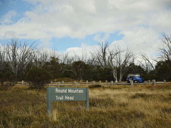
I arrived at the trail head early afternoon and was on my way shortly after 2:00pm. The weather was still looking ok at this stage with a gentle breeze blowing. It didnt take long to get to the Farm Ridge turn off and then down the hill to Round Mountain hut. I did a quick check on the hut, nobody here this time :) So I kept on going down to the Tumut river crossing - which was actually quite low. Deep enough for me to take the boots off, but only just.


Once across the river, the climb up Farm Ridge begins. Its not really steep, but it does keep going on and on for several kilometers. I finally reached a spot to have a rest, and looked down to where my map should be - no map - bugger! I had rigged up some string to hold it to my pack while I walked, and this had obviously come loose and the map fallen to the ground. So I turned around and head back along the track nearly a kilometer before I found it!
Continuing from where I found the map, I made it up to the top of the ridge line by early afternoon. I wasnt under any time pressure this weekend so I decided to start looking for a camp site. I needed something on the Western side of the ridge to take advantage of the sunset tonight, which was looking like it would be a good one. I found a great spot around 5:00pm which also sounded like a good time to stop.
I quickly setup camp next to some old fallen timber to assist in the fire building process. Once camp was setup I started work on my first time lapse photo session of the trip. As well as training my body for Nepal, I'm also trying to improve my camera skills to assist in capturing what will be a visual feast of plenty.
First lesson I learned today was in the use of my new GPS device. Turning on is not always enough, you need to remember to also start sending satellite updates, or nobody will know where you are...
Day 2 - A flexible plan is a good plan (13kms)
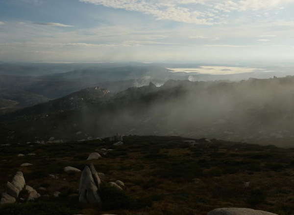
I didnt get up too early, as it was quite cold out and I could also see that the ridge was completely surrounded in cloud. Eventually I got up, and as expected visibility was pretty low! But within a short while, the cloud started to settle and I could see Round Mountain popping out in the distance, as well as the Toolong range on the other side of the valley. It was quite spectacular.

I slowly packed up, waiting for the sun to emerge and start drying out the moisture from my tent. I eventually got things packed up and was on the road by about 9:30am. The plan was to head down to the old ruin of O'Keefes hut and then find the back country track up to Jagungal.
The morning was amazing, and the walk pretty easy over the top of the ridge. Mount Jagungal continued to poke its head out everytime I walked into a clearing. It wasnt long before I started to descend to the bottom of Farm Ridge.
From the base of the ridge, I hit Grey Mare fire trail which I continued to follow over a couple of creeks until I eventually arrived at what I was expecting to be O'Keefes ruin - except it had been rebuilt! And an amazing job they did with it, this hut is almost a work of art!
I spent some time here, not only admiring the new hut, but also contemplating my next move. Since I had been here several years ago, it looks like the undergrowth up to Jagungal had significantly increased. And being a lone hiker, I always think twice about heading off into an area that could put my safety at risk. So I eventually decided that I would continue along Grey Mare fire trail as far as I could. If I managed to get to the standard climb up Jagungal that would be great, otherwise - just enjoy the day.
But I am never one to scoff at a challenge. It may have been optimistic to think I could travel all the way to the top the The Big Jay in one day from where I was, but I would give it a good crack!
To my surprise it only took about an hour to get to the base of Mount Jagungal and the South Western climbing point. I was thinking from here that I may not make it to the summit tonight, but at least getting up on the ridge line would be good. So off I went.
Once again, to my surprise it took only an hour and a half to get to the summit!
The walk hard of course, and with a full pack it certainly took its toll on me, but I got up there with plenty of time to check out the summit before continuing on to the North East a little to setup camp - with another sunset position.
In future it would be a good thing to remember that camping along the Northern ridge line would be much better, there is plenty of fire wood along here and the views would be at least as good as from where I camped.
Another lesson learned today, dont underestimate yourself. And also, not only do you need to turn the tracking on, you also need to have the entire device on for it to work! Tomorrow I will get everything right!
Day 3 - Weather changes everything (26kms)
I woke to another morning shrouded in cloud - not all that unexpected when I was camped at over 2000m! The cloud burnt off again once the sun came out, but today things took a little longer to dry out. As a consequence I had to pack up a wet tent and head off once

South so I didnt want to get caught up here if things turned bad.
I quickly made my way back over to Jagungal saddle and started to descend to the ridge line. I was stopped suddenly by a large dingo perched on a rock ahead of me. I dont think he saw or heard me, but I could here some other hikers coming up from the South, and he heard them and ran off down into the valley. Shortly after this experience, I bumped into those hikers as they were making their way up to the summit - they would be the first of many I would encounter today!
I continued my way off the mountain as it started to get darker off to the south. I made it to the bottom of the mountain at about 11:30am and decided to head off to the South along Grey Mare fire trail. Earlier in the morning I had contemplated taking the off track trail that leads from the ridge out to Strumbo Hill and back onto Grey Mare further South. I had changed my mind due to the changing weather but also wanted to get out to where the old trail met Grey Mare.
I made it out to the junction just as it started raining. And looking back up Strumbo Hill from the small rock cairn, it appears that this trail is also very over grown and would have been hard work to navigate. After a short lunch break, I heade back to the North to retrace my steps to Round Mountain track and back towards the car.
I am not sure when I finally made the decision, but due to the consistent rain now I decided that I would just continue to push on until I got back to the car tonight. I was a long walk, but I was lucky that once up on the Toolong range, I could pick up the Swans game on the radio which spurred me on!
I arrived back at the car around 6:00pm rather wet and definitely tired!
References
| Jagungal Weather |
Google Maps
- all
- day-01
- day-02
- day-03
- photos
![Jagungal Jagungal - Return to Easter Kosi trips<div style='float: right;'>[2015:04:02 06:54:17] [KOSI-EASTER-20150402-01.jpg]</div>](../CACHE/THUMB/Thumb-MEDIA201504-APRILJAGUNGALKOSI-EASTER-20150402-01.jpg.jpg)
![Jagungal Jagungal - Return to Easter Kosi trips<div style='float: right;'>[2015:04:02 06:54:47] [KOSI-EASTER-20150402-02.jpg]</div>](../CACHE/THUMB/Thumb-MEDIA201504-APRILJAGUNGALKOSI-EASTER-20150402-02.jpg.jpg)
![Jagungal Jagungal - Return to Easter Kosi trips<div style='float: right;'>[2015:04:02 14:03:30] [KOSI-EASTER-20150402-03.jpg]</div>](../CACHE/THUMB/Thumb-MEDIA201504-APRILJAGUNGALKOSI-EASTER-20150402-03.jpg.jpg)
![Jagungal Jagungal - Return to Easter Kosi trips<div style='float: right;'>[2015:04:02 14:16:14] [KOSI-EASTER-20150402-04.jpg]</div>](../CACHE/THUMB/Thumb-MEDIA201504-APRILJAGUNGALKOSI-EASTER-20150402-04.jpg.jpg)
![Jagungal Jagungal - Return to Easter Kosi trips<div style='float: right;'>[2015:04:02 14:23:12] [KOSI-EASTER-20150402-05.jpg]</div>](../CACHE/THUMB/Thumb-MEDIA201504-APRILJAGUNGALKOSI-EASTER-20150402-05.jpg.jpg)
![Jagungal Jagungal - Return to Easter Kosi trips<div style='float: right;'>[2015:04:02 14:45:29] [KOSI-EASTER-20150402-06.jpg]</div>](../CACHE/THUMB/Thumb-MEDIA201504-APRILJAGUNGALKOSI-EASTER-20150402-06.jpg.jpg)
![Jagungal Jagungal - Return to Easter Kosi trips<div style='float: right;'>[2015:04:02 14:46:54] [KOSI-EASTER-20150402-07.jpg]</div>](../CACHE/THUMB/Thumb-MEDIA201504-APRILJAGUNGALKOSI-EASTER-20150402-07.jpg.jpg)
![Jagungal Jagungal - Return to Easter Kosi trips<div style='float: right;'>[2015:04:02 14:49:33] [KOSI-EASTER-20150402-08.jpg]</div>](../CACHE/THUMB/Thumb-MEDIA201504-APRILJAGUNGALKOSI-EASTER-20150402-08.jpg.jpg)
![Jagungal Jagungal - Return to Easter Kosi trips<div style='float: right;'>[2015:04:02 15:11:28] [KOSI-EASTER-20150402-09.jpg]</div>](../CACHE/THUMB/Thumb-MEDIA201504-APRILJAGUNGALKOSI-EASTER-20150402-09.jpg.jpg)
![Jagungal Jagungal - Return to Easter Kosi trips<div style='float: right;'>[2015:04:02 15:14:02] [KOSI-EASTER-20150402-10.jpg]</div>](../CACHE/THUMB/Thumb-MEDIA201504-APRILJAGUNGALKOSI-EASTER-20150402-10.jpg.jpg)
![Jagungal Jagungal - Return to Easter Kosi trips<div style='float: right;'>[2015:04:02 15:49:58] [KOSI-EASTER-20150402-11.jpg]</div>](../CACHE/THUMB/Thumb-MEDIA201504-APRILJAGUNGALKOSI-EASTER-20150402-11.jpg.jpg)
![Jagungal Jagungal - Return to Easter Kosi trips<div style='float: right;'>[2015:04:02 16:51:13] [KOSI-EASTER-20150402-12.jpg]</div>](../CACHE/THUMB/Thumb-MEDIA201504-APRILJAGUNGALKOSI-EASTER-20150402-12.jpg.jpg)
![Jagungal Jagungal - Return to Easter Kosi trips<div style='float: right;'>[2015:04:02 17:44:39] [KOSI-EASTER-20150402-13.jpg]</div>](../CACHE/THUMB/Thumb-MEDIA201504-APRILJAGUNGALKOSI-EASTER-20150402-13.jpg.jpg)
![Jagungal Jagungal - Return to Easter Kosi trips<div style='float: right;'>[2015:04:02 18:56:17] [KOSI-EASTER-20150402-14.jpg]</div>](../CACHE/THUMB/Thumb-MEDIA201504-APRILJAGUNGALKOSI-EASTER-20150402-14.jpg.jpg)
![Jagungal Jagungal - Return to Easter Kosi trips<div style='float: right;'>[2015:04:03 07:29:45] [KOSI-EASTER-20150403-15.jpg]</div>](../CACHE/THUMB/Thumb-MEDIA201504-APRILJAGUNGALKOSI-EASTER-20150403-15.jpg.jpg)
![Jagungal Jagungal - Return to Easter Kosi trips<div style='float: right;'>[2015:04:03 07:30:35] [KOSI-EASTER-20150403-16.jpg]</div>](../CACHE/THUMB/Thumb-MEDIA201504-APRILJAGUNGALKOSI-EASTER-20150403-16.jpg.jpg)
![Jagungal Jagungal - Return to Easter Kosi trips<div style='float: right;'>[2015:04:03 08:12:57] [KOSI-EASTER-20150403-17.jpg]</div>](../CACHE/THUMB/Thumb-MEDIA201504-APRILJAGUNGALKOSI-EASTER-20150403-17.jpg.jpg)
![Jagungal Jagungal - Return to Easter Kosi trips<div style='float: right;'>[2015:04:03 09:29:52] [KOSI-EASTER-20150403-18.jpg]</div>](../CACHE/THUMB/Thumb-MEDIA201504-APRILJAGUNGALKOSI-EASTER-20150403-18.jpg.jpg)
![Jagungal Jagungal - Return to Easter Kosi trips<div style='float: right;'>[2015:04:03 09:31:13] [KOSI-EASTER-20150403-19.jpg]</div>](../CACHE/THUMB/Thumb-MEDIA201504-APRILJAGUNGALKOSI-EASTER-20150403-19.jpg.jpg)
![Jagungal Jagungal - Return to Easter Kosi trips<div style='float: right;'>[2015:04:03 10:17:06] [KOSI-EASTER-20150403-20.jpg]</div>](../CACHE/THUMB/Thumb-MEDIA201504-APRILJAGUNGALKOSI-EASTER-20150403-20.jpg.jpg)
![Jagungal Jagungal - Return to Easter Kosi trips<div style='float: right;'>[2015:04:03 10:36:34] [KOSI-EASTER-20150403-21.jpg]</div>](../CACHE/THUMB/Thumb-MEDIA201504-APRILJAGUNGALKOSI-EASTER-20150403-21.jpg.jpg)
![Jagungal Jagungal - Return to Easter Kosi trips<div style='float: right;'>[2015:04:03 10:57:09] [KOSI-EASTER-20150403-22.jpg]</div>](../CACHE/THUMB/Thumb-MEDIA201504-APRILJAGUNGALKOSI-EASTER-20150403-22.jpg.jpg)
![Jagungal Jagungal - Return to Easter Kosi trips<div style='float: right;'>[2015:04:03 12:09:39] [KOSI-EASTER-20150403-23.jpg]</div>](../CACHE/THUMB/Thumb-MEDIA201504-APRILJAGUNGALKOSI-EASTER-20150403-23.jpg.jpg)
![Jagungal Jagungal - Return to Easter Kosi trips<div style='float: right;'>[2015:04:03 12:26:01] [KOSI-EASTER-20150403-24.jpg]</div>](../CACHE/THUMB/Thumb-MEDIA201504-APRILJAGUNGALKOSI-EASTER-20150403-24.jpg.jpg)
![Jagungal Jagungal - Return to Easter Kosi trips<div style='float: right;'>[2015:04:03 12:31:54] [KOSI-EASTER-20150403-25.jpg]</div>](../CACHE/THUMB/Thumb-MEDIA201504-APRILJAGUNGALKOSI-EASTER-20150403-25.jpg.jpg)
![Jagungal Jagungal - Return to Easter Kosi trips<div style='float: right;'>[2015:04:03 12:37:41] [KOSI-EASTER-20150403-26.jpg]</div>](../CACHE/THUMB/Thumb-MEDIA201504-APRILJAGUNGALKOSI-EASTER-20150403-26.jpg.jpg)
![Jagungal Jagungal - Return to Easter Kosi trips<div style='float: right;'>[2015:04:03 12:37:53] [KOSI-EASTER-20150403-27.jpg]</div>](../CACHE/THUMB/Thumb-MEDIA201504-APRILJAGUNGALKOSI-EASTER-20150403-27.jpg.jpg)
![Jagungal Jagungal - Return to Easter Kosi trips<div style='float: right;'>[2015:04:03 12:38:04] [KOSI-EASTER-20150403-28.jpg]</div>](../CACHE/THUMB/Thumb-MEDIA201504-APRILJAGUNGALKOSI-EASTER-20150403-28.jpg.jpg)
![Jagungal Jagungal - Return to Easter Kosi trips<div style='float: right;'>[2015:04:03 13:46:55] [KOSI-EASTER-20150403-29.jpg]</div>](../CACHE/THUMB/Thumb-MEDIA201504-APRILJAGUNGALKOSI-EASTER-20150403-29.jpg.jpg)
![Jagungal Jagungal - Return to Easter Kosi trips<div style='float: right;'>[2015:04:03 14:25:55] [KOSI-EASTER-20150403-30.jpg]</div>](../CACHE/THUMB/Thumb-MEDIA201504-APRILJAGUNGALKOSI-EASTER-20150403-30.jpg.jpg)
![Jagungal Jagungal - Return to Easter Kosi trips<div style='float: right;'>[2015:04:03 15:03:24] [KOSI-EASTER-20150403-31.jpg]</div>](../CACHE/THUMB/Thumb-MEDIA201504-APRILJAGUNGALKOSI-EASTER-20150403-31.jpg.jpg)
![Jagungal Jagungal - Return to Easter Kosi trips<div style='float: right;'>[2015:04:03 15:16:01] [KOSI-EASTER-20150403-32.jpg]</div>](../CACHE/THUMB/Thumb-MEDIA201504-APRILJAGUNGALKOSI-EASTER-20150403-32.jpg.jpg)
![Jagungal Jagungal - Return to Easter Kosi trips<div style='float: right;'>[2015:04:03 15:24:40] [KOSI-EASTER-20150403-33.jpg]</div>](../CACHE/THUMB/Thumb-MEDIA201504-APRILJAGUNGALKOSI-EASTER-20150403-33.jpg.jpg)
![Jagungal Jagungal - Return to Easter Kosi trips<div style='float: right;'>[2015:04:03 15:28:52] [KOSI-EASTER-20150403-34.jpg]</div>](../CACHE/THUMB/Thumb-MEDIA201504-APRILJAGUNGALKOSI-EASTER-20150403-34.jpg.jpg)
![Jagungal Jagungal - Return to Easter Kosi trips<div style='float: right;'>[2015:04:03 15:36:22] [KOSI-EASTER-20150403-35.jpg]</div>](../CACHE/THUMB/Thumb-MEDIA201504-APRILJAGUNGALKOSI-EASTER-20150403-35.jpg.jpg)
![Jagungal Jagungal - Return to Easter Kosi trips<div style='float: right;'>[2015:04:03 15:45:49] [KOSI-EASTER-20150403-36.jpg]</div>](../CACHE/THUMB/Thumb-MEDIA201504-APRILJAGUNGALKOSI-EASTER-20150403-36.jpg.jpg)
![Jagungal Jagungal - Return to Easter Kosi trips<div style='float: right;'>[2015:04:03 16:08:25] [KOSI-EASTER-20150403-37.jpg]</div>](../CACHE/THUMB/Thumb-MEDIA201504-APRILJAGUNGALKOSI-EASTER-20150403-37.jpg.jpg)
![Jagungal Jagungal - Return to Easter Kosi trips<div style='float: right;'>[2015:04:03 16:26:22] [KOSI-EASTER-20150403-38.jpg]</div>](../CACHE/THUMB/Thumb-MEDIA201504-APRILJAGUNGALKOSI-EASTER-20150403-38.jpg.jpg)
![Jagungal Jagungal - Return to Easter Kosi trips<div style='float: right;'>[2015:04:03 17:50:50] [KOSI-EASTER-20150403-39.jpg]</div>](../CACHE/THUMB/Thumb-MEDIA201504-APRILJAGUNGALKOSI-EASTER-20150403-39.jpg.jpg)
![Jagungal Jagungal - Return to Easter Kosi trips<div style='float: right;'>[2015:04:03 17:54:05] [KOSI-EASTER-20150403-40.jpg]</div>](../CACHE/THUMB/Thumb-MEDIA201504-APRILJAGUNGALKOSI-EASTER-20150403-40.jpg.jpg)
![Jagungal Jagungal - Return to Easter Kosi trips<div style='float: right;'>[2015:04:03 18:56:29] [KOSI-EASTER-20150403-41.jpg]</div>](../CACHE/THUMB/Thumb-MEDIA201504-APRILJAGUNGALKOSI-EASTER-20150403-41.jpg.jpg)
![Jagungal Jagungal - Return to Easter Kosi trips<div style='float: right;'>[2015:04:03 19:01:49] [KOSI-EASTER-20150403-42.jpg]</div>](../CACHE/THUMB/Thumb-MEDIA201504-APRILJAGUNGALKOSI-EASTER-20150403-42.jpg.jpg)
![Jagungal Jagungal - Return to Easter Kosi trips<div style='float: right;'>[2015:04:04 07:36:44] [KOSI-EASTER-20150404-43.jpg]</div>](../CACHE/THUMB/Thumb-MEDIA201504-APRILJAGUNGALKOSI-EASTER-20150404-43.jpg.jpg)
![Jagungal Jagungal - Return to Easter Kosi trips<div style='float: right;'>[2015:04:04 08:26:17] [KOSI-EASTER-20150404-44.jpg]</div>](../CACHE/THUMB/Thumb-MEDIA201504-APRILJAGUNGALKOSI-EASTER-20150404-44.jpg.jpg)
![Jagungal Jagungal - Return to Easter Kosi trips<div style='float: right;'>[2015:04:04 09:07:40] [KOSI-EASTER-20150404-45.jpg]</div>](../CACHE/THUMB/Thumb-MEDIA201504-APRILJAGUNGALKOSI-EASTER-20150404-45.jpg.jpg)
![Jagungal Jagungal - Return to Easter Kosi trips<div style='float: right;'>[2015:04:04 09:11:46] [KOSI-EASTER-20150404-46.jpg]</div>](../CACHE/THUMB/Thumb-MEDIA201504-APRILJAGUNGALKOSI-EASTER-20150404-46.jpg.jpg)
![Jagungal Jagungal - Return to Easter Kosi trips<div style='float: right;'>[2015:04:04 10:47:21] [KOSI-EASTER-20150404-47.jpg]</div>](../CACHE/THUMB/Thumb-MEDIA201504-APRILJAGUNGALKOSI-EASTER-20150404-47.jpg.jpg)
![Jagungal Jagungal - Return to Easter Kosi trips<div style='float: right;'>[2015:04:04 11:38:02] [KOSI-EASTER-20150404-48.jpg]</div>](../CACHE/THUMB/Thumb-MEDIA201504-APRILJAGUNGALKOSI-EASTER-20150404-48.jpg.jpg)
![Jagungal Jagungal - Return to Easter Kosi trips<div style='float: right;'>[2015:04:04 11:41:02] [KOSI-EASTER-20150404-49.jpg]</div>](../CACHE/THUMB/Thumb-MEDIA201504-APRILJAGUNGALKOSI-EASTER-20150404-49.jpg.jpg)
![Jagungal Jagungal - Return to Easter Kosi trips<div style='float: right;'>[2015:04:04 11:57:33] [KOSI-EASTER-20150404-50.jpg]</div>](../CACHE/THUMB/Thumb-MEDIA201504-APRILJAGUNGALKOSI-EASTER-20150404-50.jpg.jpg)
![Jagungal Jagungal - Return to Easter Kosi trips<div style='float: right;'>[2015:04:04 13:02:51] [KOSI-EASTER-20150404-51.jpg]</div>](../CACHE/THUMB/Thumb-MEDIA201504-APRILJAGUNGALKOSI-EASTER-20150404-51.jpg.jpg)
![Jagungal Jagungal - Return to Easter Kosi trips<div style='float: right;'>[2015:04:04 13:26:20] [KOSI-EASTER-20150404-52.jpg]</div>](../CACHE/THUMB/Thumb-MEDIA201504-APRILJAGUNGALKOSI-EASTER-20150404-52.jpg.jpg)
![Jagungal Jagungal - Return to Easter Kosi trips<div style='float: right;'>[2015:04:04 15:15:26] [KOSI-EASTER-20150404-53.jpg]</div>](../CACHE/THUMB/Thumb-MEDIA201504-APRILJAGUNGALKOSI-EASTER-20150404-53.jpg.jpg)
![Jagungal Jagungal - Return to Easter Kosi trips<div style='float: right;'>[2015:04:04 15:15:59] [KOSI-EASTER-20150404-54.jpg]</div>](../CACHE/THUMB/Thumb-MEDIA201504-APRILJAGUNGALKOSI-EASTER-20150404-54.jpg.jpg)
![Jagungal Jagungal - Return to Easter Kosi trips<div style='float: right;'>[2015:04:04 18:03:14] [KOSI-EASTER-20150404-55.jpg]</div>](../CACHE/THUMB/Thumb-MEDIA201504-APRILJAGUNGALKOSI-EASTER-20150404-55.jpg.jpg)
![Jagungal Jagungal - Return to Easter Kosi trips<div style='float: right;'>[2015:04:05 06:26:21] [KOSI-EASTER-20150405-56.jpg]</div>](../CACHE/THUMB/Thumb-MEDIA201504-APRILJAGUNGALKOSI-EASTER-20150405-56.jpg.jpg)
![Jagungal Jagungal - Return to Easter Kosi trips<div style='float: right;'>[2015:04:05 07:24:25] [KOSI-EASTER-20150405-57.jpg]</div>](../CACHE/THUMB/Thumb-MEDIA201504-APRILJAGUNGALKOSI-EASTER-20150405-57.jpg.jpg)
![Jagungal Jagungal - Return to Easter Kosi trips<div style='float: right;'>[2015:04:05 07:26:58] [KOSI-EASTER-20150405-58.jpg]</div>](../CACHE/THUMB/Thumb-MEDIA201504-APRILJAGUNGALKOSI-EASTER-20150405-58.jpg.jpg)
![Jagungal Jagungal - Return to Easter Kosi trips<div style='float: right;'>[2015:04:05 08:16:01] [KOSI-EASTER-20150405-59.jpg]</div>](../CACHE/THUMB/Thumb-MEDIA201504-APRILJAGUNGALKOSI-EASTER-20150405-59.jpg.jpg)
![Jagungal Jagungal - Return to Easter Kosi trips<div style='float: right;'>[2015:04:05 08:19:58] [KOSI-EASTER-20150405-60.jpg]</div>](../CACHE/THUMB/Thumb-MEDIA201504-APRILJAGUNGALKOSI-EASTER-20150405-60.jpg.jpg)
